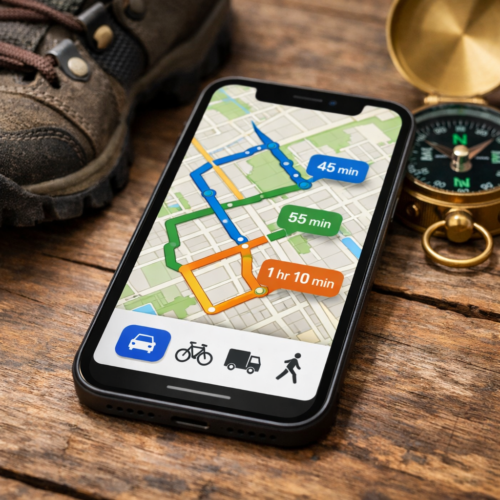
Which Map Apps Let You Adjust Routes by Vehicle Type?
Which Map Apps Let You Adjust Routes by Vehicle Type?
Most mainstream map apps are great for traffic and ease of use, but they don’t reliably account for vehicle height, weight, propane tanks, or hazmat rules. If you drive an RV, box truck, or run deliveries, you need a vehicle-aware route planner that can avoid low bridges, weight limits, and emission zones. In short: use Google Maps or Waze for everyday driving; choose dedicated truck/RV navigation for legal compliance; and step up to fleet planners when you’re optimizing multiple vehicles and stops. Below, we break down what vehicle-aware routing really means, which apps support it, how offline maps factor into backcountry gaps, and where budget picks like CoPilot fit.
How vehicle type affects routing
Vehicle-aware routing adjusts directions using your vehicle’s dimensions, weight, cargo type, and sometimes fuel/emissions standard to comply with local rules. It helps avoid low-clearance bridges, weight-restricted roads, hazardous-material prohibitions, and clean-air zones while improving safety and minimizing fines.
Concrete examples include steering tall RVs around low bridges and routing box trucks away from 10-ton limits. Truck apps can also account for hazmat restrictions and low-emission zones—Sygic adds controls by Euro standard and vehicle year, plus full vehicle parameters—features consumer apps typically lack (Sygic Truck & Caravan). Consumer apps excel at live traffic, but they don’t consistently enforce truck dimensions or weight limits (PCMag’s Best Navigation Apps).
What to look for in vehicle-aware map apps
- Vehicle profiles and parameters: Set height, length, width, gross weight, axle count, and hazmat where supported (Sygic includes full profiles for truck, RV/bus, van, car).
- Legal restrictions: Reliable avoidance of low bridges, weight limits, emission zones, and truck bans (SmartTruckRoute highlights both permanent and temporary restrictions; Sygic supports emission-zone logic).
- Offline maps: Critical if you drive through backcountry or cellular dead zones; CoPilot is a strong offline pick (Badger Maps’ navigation roundup).
- Dispatch/optimization: For multi-vehicle operations, look for stop sequencing, vehicle-capacity constraints, and driver dispatch (see DispatchTrack’s route planner guide).
Route optimization is the process of sequencing many stops and matching jobs to vehicles to cut drive time, reduce fuel use, and lower fleet costs while meeting delivery windows, capacities, skills, and other constraints. It’s the backbone of efficient multi-vehicle planning and dispatch.
Hiking Manual’s quick answer and recommendations
Bottom line: Use consumer apps for car trips and live traffic. Switch to truck/RV apps whenever height, weight, propane, or emission-zone rules matter. Adopt fleet planners when you’re routing multiple vehicles and need automated optimization.
Quick picks:
- Best consumer: Waze or Google Maps for live traffic; note Waze’s vehicle settings but no true offline navigation (as reviewed by PCMag).
- Best RV/truck starter: CoPilot GPS with vehicle-type presets and full offline maps; a budget-friendly entry around $14.99/year (Badger Maps).
- Best pro truck features: Sygic Truck or SmartTruckRoute for detailed parameters, restriction updates, and legal compliance.
Consumer navigation apps
These excel at traffic, incident reporting, and usability, but they don’t consistently enforce truck-legal routing. Use them for car trips; switch to a truck/RV app when size or cargo rules apply (PCMag’s Best Navigation Apps).
Google Maps
Great for everyday driving with excellent traffic data and fast rerouting. It does not reliably avoid low bridges or weight limits and lacks full truck dimension enforcement. You can toggle to avoid tolls/highways, but that’s not a substitute for vehicle profiles. Ideal for day trips, car travel, and quick reroutes.
Waze
A top pick for real-time, community-powered alerts with some vehicle-type settings. Still not truck-compliant and lacks true offline maps, relying on live data. Best for commuter traffic, incident reports, and ad hoc reroutes when you have coverage.
Apple Maps
Solid car navigation with polished rerouting and lane guidance, but not designed for truck-legal routing. Use it for urban driving and road trips with good cellular service; upgrade to CoPilot or a truck-first app for RVs and large vans.
Truck and RV navigation apps
These apps use vehicle height, weight, hazmat, and emissions to route you legally, and they generally offer offline maps for reliability.
Sygic Truck and Caravan
Sygic supports full vehicle parameters—length, height, weight, axles, and hazmat—with profiles for trucks, RV/bus, vans, and cars. It can avoid emission zones using Euro standard and vehicle year, includes offline maps, and even offers a Google Maps Route Sender workflow for up to 10 stops (Sygic Truck & Caravan).
CoPilot GPS
An entry-level option with vehicle-type routing for car, RV, and truck plus fully offline navigation, making it a smart backup when coverage drops. Pricing often starts around $14.99/year—great value for RVers. Set your rig’s height/width to avoid low clearances (source: Badger Maps’ navigation roundup).
SmartTruckRoute
Truck-first routing that avoids low bridges and weight limits, with hourly updates to permanent and temporary restrictions. Available on Android and iOS phones or tablets, with noted live support—ideal for independent drivers and small fleets focused on economical compliance (SmartTruckRoute).
Fleet and route planning platforms
Built for businesses running multiple vehicles, these tools optimize routes, consider vehicle capacities/types, dispatch to drivers, and integrate traffic into ETAs—usually at higher price points.
Route4Me
A popular planner that automatically minimizes vehicle count, and that setting can’t be changed. In testing, its ETA estimates skewed significantly lower than competitors—validate with trials before committing (Routific’s review of delivery planners).
Optimoroute
Accessible pricing tiers for SMB fleets—examples include $35 per vehicle/month for 700 orders and $44 per vehicle/month up to 1,000 orders (as reported by Routific). Supports multi-vehicle planning and dispatch; check stop and order limits during trials.
Descartes
Enterprise-grade optimization with support for detailed constraints, including vehicle types and driving rules. Best for complex operations needing compliance, system integrations, and role-based routing—expect higher cost and longer implementations (Kardinal’s guide to route optimization software).
Side-by-side comparison criteria
Below is a quick-scan table contrasting core capabilities and fit.
| App | Vehicle Profiles/Restrictions | Offline Maps | Live Traffic | Emissions/EV | Cost/Ease |
|---|---|---|---|---|---|
| Google Maps | Car modes only; no truck enforcement | Limited | Excellent | EV chargers; no truck emissions | Free; very easy |
| Waze | Some vehicle settings; not truck-legal | No (true) | Excellent | EV chargers; no truck emissions | Free; very easy |
| Apple Maps | Car navigation only | Limited | Excellent | EV chargers; no truck emissions | Free; very easy |
| CoPilot GPS | Car/RV/Truck presets; height/width | Yes | Good | Limited | ~$15/yr; easy |
| Sygic Truck | Full truck/RV params; low bridge/limits | Yes | Good | Emission-zone avoidance | Paid; moderate |
| SmartTruckRoute | Truck-legal routes; hourly restriction updates | Partial/Online-focused | Good | Limited | Subscription; easy |
| Route4Me | Fleet constraints via optimization | N/A (planner) | Integrated | N/A | Paid; moderate |
| Optimoroute | Multi-vehicle capacities/types | N/A (planner) | Integrated | N/A | $35–$44/vehicle; moderate |
| Descartes | Enterprise constraints, rules, compliance | N/A (platform) | Integrated | N/A | Enterprise; advanced |
Vehicle profiles and legal restrictions
- Sygic Truck offers full vehicle parameters and multiple profiles.
- SmartTruckRoute actively avoids low bridges and weight limits, updating restrictions hourly.
- CoPilot provides practical car/RV/truck presets for quick setup.
- Consumer apps don’t enforce truck dimensions or weight limits and should not be used for compliance.
Offline maps and coverage
- CoPilot delivers full offline navigation—great for RVers and backcountry gaps.
- Sygic Truck supports offline maps with truck/RV profiles.
- Waze lacks true offline maps and depends on connectivity. Pros:
- Reliable guidance in dead zones
- Lower battery/data use Cons:
- Map updates require manual downloads
- Live traffic may be limited
Live traffic and rerouting
- Waze and Google Maps lead on real-time traffic and community incident reports.
- Truck/RV apps offer adequate traffic but prioritize legal compliance over crowd-sourced alerts.
- Fleet platforms integrate traffic into ETAs; note that Route4Me’s ETAs tested low versus peers (Routific).
EV and emissions support
Emission-zone routing ensures vehicles comply with low-emission or clean-air regulations by evaluating fuel type, emissions standard (e.g., Euro class), and sometimes vehicle year to avoid restricted areas. It keeps noncompliant vehicles out of LEZs while maintaining feasible, legal routes.
Sygic Truck includes emission-zone avoidance using Euro standard and vehicle year. Most consumer apps surface EV charging but don’t provide truck emissions compliance controls.
Cost and ease of use
- CoPilot’s roughly $14.99/year entry price is budget-friendly for RVers.
- Optimoroute tiers are around $35–$44 per vehicle/month in common SMB scenarios (Routific).
- Free route optimizers like RouteXL (up to 20 stops) or MapQuest (up to 26) can help small jobs but aren’t built for large-scale planning, per Routific’s review.
| Category | Example Apps | Price Ballpark | Learning Curve |
|---|---|---|---|
| Consumer navigation | Google Maps, Waze, Apple | Free | Easy |
| RV/truck navigation | CoPilot, Sygic, STR | ~$15/yr to subscription | Easy–Moderate |
| Fleet planners | Route4Me, Optimoroute | ~$35–$44/vehicle/month | Moderate |
| Enterprise suites | Descartes | Custom/enterprise | Advanced |
Best use cases and recommendations
Everyday driving and weekend trips
- Use Waze or Google Maps for live traffic and fast rerouting.
- Headed off-grid? Carry an offline-capable backup like CoPilot to stay navigable when coverage drops.
RV travel and large vans
- Start with CoPilot GPS for budget-friendly height/width avoidance and offline maps.
- Upgrade to Sygic Truck & Caravan for granular dimensions, hazmat toggles, and emission-zone avoidance.
Commercial trucking and HGV
- Choose SmartTruckRoute for hourly restriction updates and truck-legal routing.
- Use Sygic Truck when you need multiple profiles, hazmat, and emissions settings.
Multi-vehicle delivery operations
- Try Optimoroute for SMB-friendly pricing and straightforward onboarding.
- Consider Route4Me when reducing vehicle count is a priority (its algorithm aggressively consolidates).
- Pick Descartes for complex constraints, compliance, and integrations at enterprise scale.
Skill-based routing assigns jobs based on required capabilities—like liftgate, refrigeration, or hazmat certification—so each stop is matched to the right vehicle and driver. This improves first-attempt success, safety, and service reliability (as described by DispatchTrack).
Safety and compliance considerations
Large vehicles routed like cars risk fines, bridge strikes, and delays. Hiking Manual recommends prioritizing legal compliance over saving a few minutes.
- Use truck-legal routing to avoid low bridges and weight limits (SmartTruckRoute’s specialty).
- Configure emission-zone rules by Euro class where available (supported in Sygic).
- For fleets, match equipment and certified drivers to routes to meet safety and legal requirements. Pre-trip checklist:
- Measure total height (include AC units, racks).
- Confirm gross weight, axle count, and class.
- Verify hazmat status and permits.
- Review regional LEZ/ULEZ rules.
Frequently asked questions
Can I make Google Maps avoid low bridges and truck restrictions?
Not reliably. At Hiking Manual, we advise using a dedicated truck/RV navigator when vehicle size or legal restrictions apply.
Which app is best for RV height and propane restrictions?
Choose a dedicated RV/truck app that supports height/width settings and offline maps; for more control, look for detailed vehicle parameters and emission-zone settings. Hiking Manual favors options that handle hazmat-related restrictions with full offline coverage.
Do any free apps provide true truck-legal routing?
Free options are limited; consistent low-bridge and weight-limit avoidance typically requires a paid truck/RV app. Hiking Manual recommends budgeting for a compliant solution if you drive oversized or hazardous loads.
What’s the difference between a truck GPS app and a fleet route planner?
A truck GPS app guides a single vehicle using size and restriction rules. A fleet planner optimizes multiple vehicles with dispatch and constraints; at Hiking Manual, we suggest planners when you manage many drivers or stops.
How do I set up a vehicle profile for safer routing?
Measure total height (including roof gear), width, length, weight, and axle count, then add cargo type if supported. Enable low-bridge, weight-limit, and emission-zone rules—Hiking Manual treats accurate profiles as non-negotiable for compliance.