Stop Guessing Climbs: Top Tools Showing Cycling Route Elevation Gain
Stop Guessing Climbs: Top Tools Showing Cycling Route Elevation Gain
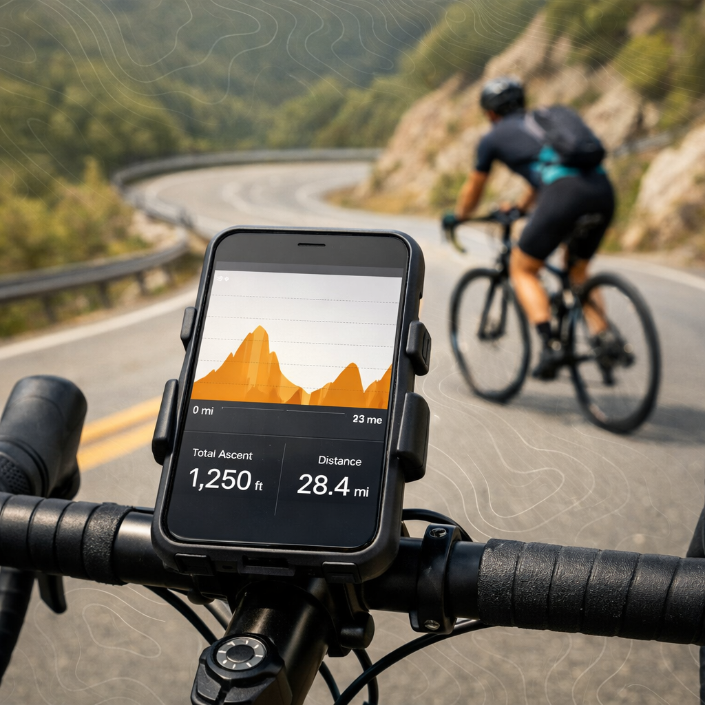
If you’ve ever finished a ride feeling like the climbs were way steeper than the map suggested, you’re not alone. Elevation gain—the sum of all uphill meters or feet on a route—is where most plans go sideways. Good news: modern cycling route planners show clear elevation profiles, export clean GPX/FIT files, and even run offline so you can navigate climbs without stress. Below, we compare the most reliable tools, explain why their numbers differ, and show you how to cross-check gain so you never get surprised by a wall mid-ride.
How tools calculate elevation gain: they sample altitude along your planned line using a digital elevation model (or your device’s barometer) and add up only the positive (uphill) changes. Smoothing, sampling rate, and data source all affect the total.
Quick comparison at a glance
| Tool | Platforms | Elevation accuracy notes | Exports | Offline / turn-by-turn | Cost tier | Standout features |
|---|---|---|---|---|---|---|
| Strava | Web, iOS, Android | Good on roads; DEM + correction; segments add context | GPX/TCX via sync | Basic mobile nav; offline limited | Free + Subscription | Segment-aware planning, community data |
| Komoot | Web, iOS, Android | Clear profiles; solid DEM; terrain-aware | GPX; device sync | Strong offline + TBT | Free + Paid regions/Premium | Great for gravel/bikepacking |
| RideWithGPS | Web, iOS, Android | Detailed profiles; climb filters | GPX/TCX/FIT | Offline TBT in app | Free, Basic, Premium | Cue sheets, event workflows |
| Garmin Connect | Web, iOS, Android | Best when paired with barometer-equipped head units | FIT/GPX | Offline via head unit | Free (with device) | Hardware-corrected elevation |
| MapMyRide | Web, iOS, Android | Fast estimates; less detail | GPX | Limited | Free + MVP | Quick sketching, phone-first |
| Google Maps | Web, iOS, Android | Basic elevation charts; not cycling-specific for gain accuracy | KML via My Maps | Limited | Free | Fast preview of climb shape |
| Google Earth | Web, Desktop | Great 3D slope visualization; no ride totals | KML/KMZ | No nav | Free | 3D terrain, switchbacks view |
| AllTrails | Web, iOS, Android | Trail-focused; canopy/DEM variance off-road | GPX | Offline in Plus | Free + AllTrails+ | Surfaces, difficulty, trail intel |
Hiking Manual
At Hiking Manual, we keep route planning low-stress: compare elevation gain across at least two tools, audit any steep or sustained climbs, and package offline turn-by-turn navigation before you roll. Accurate climb estimates help you right-size your day and your kit—think cushioned shoes for café stops and hike-a-bike sections, beginner-friendly trekking poles for rough pushes, a durable multi-season tent, and a lightweight hammock for multi-day comfort. Our repeatable checklist works across phones, head units, and mixed ride‑hike days.
Digital Elevation Model (DEM) in 40–50 words: A digital elevation model is a grid-based representation of ground height. Routing tools sample DEM points to estimate ascent and descent along your line. Resolution, smoothing, and tree cover influence accuracy; pairing DEM estimates with barometric altimeter data typically yields more reliable total elevation gain.
Route-auditing mini-checklist:
- Flag grades over 8% and identify any climbs longer than 10 minutes
- Mark bailout options and safe shortcuts
- Note water/food stops and surface changes
- Check bridge/rail crossings and busy junctions
Strava
Strava’s Route Builder shows a clean elevation profile as you plot, with segment-aware planning that surfaces popular climbs and historical efforts, so you can judge what a hill feels like before you commit. The free tier works for quick checks; subscribers unlock richer route planning and route exports, including device sync via connected services on the Routes page (see Strava Routes).
Strengths:
- Community segments overlay climb context and typical pacing
- Elevation correction helps reduce GPS noise on uploads and routes
- Easy sync to major head units keeps cues consistent
Quick view:
- How to see gain: create a route, watch the elevation profile and total ascent update as you add waypoints
- Exports: GPX/TCX via sync for subscribers
- Cross-check tip: validate big totals in a second app before event days
Best for:
- Riders who want segment history and social context before committing to a climb
Reference: Explore routing and elevation profiles on the Strava Routes page: Strava Routes (https://www.strava.com/routes)
Komoot
Komoot shines for terrain-aware routing and offline-first navigation. Elevation profiles are clear, with surface and waytype insights that help gravel and bikepacking riders anticipate energy costs. Komoot’s own examples make profiles easy to parse—for instance, it showcases a San Fernando route with about 1,010 m gain over 53.5 km, illustrating profile clarity and pacing needs (Komoot guide).
Quick view:
- How to see gain: set sport to Cycling/Gravel, plot your line, read the elevation profile and surface breakdown
- Exports: GPX; direct sync to Garmin/Wahoo apps
- Offline: strong; download regions for full offline turn-by-turn
Best for:
- Bikepacking/gravel routes needing offline navigation and clear elevation previews
Reference: See Komoot’s route examples and profiles: Komoot cycling guide for San Fernando (https://www.komoot.com/guide/1934419/cycling-around-san-fernando)
RideWithGPS
RideWithGPS is a planner’s toolbox: precise elevation profiles, climb highlighting and filtering, deep route editing, and printable cue sheets. It reliably exports GPX/TCX/FIT files and syncs cleanly to head units, which helps manage climbs with predictable prompts.
Quick view:
- How to see gain: build a route and use the elevation panel; toggle “Find climbs” to highlight steep sections
- Exports: GPX/TCX/FIT; device sync
- Events: plan group rides with shared routes, cues, and collections
Best for:
- Riders who want deep route editing, printable cues, and predictable device exports
Reference: Plan routes and export files on RideWithGPS (https://ridewithgps.com/)
Garmin Connect
A barometric altimeter in 40–50 words: A barometric altimeter estimates altitude from air pressure. Unlike GPS-only altitude, it produces steadier readings with less drift. When apps or devices combine barometer data with DEM-based elevation correction, total ascent typically becomes more realistic—especially across long, rolling, or mountainous routes.
Garmin Connect pairs best with an Edge or other barometer-equipped Garmin. Plan a course, sync to your device, and you’ll get elevation that benefits from hardware sensors and post-ride correction. Direct FIT/GPX export and real-time ClimbPro on compatible units help you pace every ascent more accurately than GPS-only tracks.
Best for:
- Riders using Garmin Edge units who want the most reliable, hardware-informed elevation gain
Reference: Explore planning and device sync in Garmin Connect (https://connect.garmin.com/)
MapMyRide
MapMyRide is a fast way to sketch a route and see a basic elevation profile and total gain—ideal for city loops and weekday training. Phone-first riders can get moving quickly, but for big climbing days, verify totals in a second app and ensure you have offline navigation in place.
Quick view:
- How to see gain: draw your route; the elevation chart updates under the map
- Exports: GPX
- Offline: limited compared with Komoot or RideWithGPS
Best for:
- Casual riders making quick plans who still cross-check big climbing days
Reference: Start planning with MapMyRide (https://www.mapmyride.com/)
Google Maps and Google Earth
Use Google’s tools to preview terrain and slope shape before committing. In Google Maps (desktop), cycling directions display an elevation chart—great for a fast sense of total ascent. In Google Earth, 3D terrain and satellite imagery reveal stacked switchbacks, cliff bands, and surface changes.
Mini flow:
- Trace a potential line (Maps or Earth)
- Preview the elevation chart (Maps) and rotate 3D to inspect gradients (Earth)
- Export KML (My Maps/Earth), then import to a cycling app for cues, GPX/FIT export, and offline maps
Best for:
- Quick terrain reality checks and understanding climb shape
References: Google Maps (https://www.google.com/maps) and Google Earth Web (https://earth.google.com/web/)
AllTrails
AllTrails is trail-centric: you’ll see elevation gain, surfaces, and difficulty ratings—handy for gravel connectors, forest roads, and MTB detours. Because DEMs under tree cover can be noisy and trails wander, cross-check totals with a second tool before a big off-road day.
Quick view:
- How to see gain: open a trail/route and read the elevation profile and gain total
- Exports: GPX; offline maps with AllTrails+ subscription
- Use with: a turn-by-turn app for on-bike cues
Best for:
- Off-road/gravel riders needing trail intel and basic gain before adding turn-by-turn elsewhere
Reference: Explore trail elevation on AllTrails (https://www.alltrails.com/)
How to choose the right elevation tool
Decision framework
| Use case | Accuracy need | Exports | Offline/turn-by-turn | Best pick(s) |
|---|---|---|---|---|
| Social segments, quick planning | Moderate | GPX/TCX via sync | Optional | Strava |
| Bikepacking/gravel | High | GPX/FIT | Strong offline | Komoot + Garmin |
| Event planning, group rides | High | GPX/TCX/FIT | Optional/strong | RideWithGPS |
| Head unit integration | Highest | FIT/GPX | Device-native | Garmin Connect |
| Casual city loops | Low–moderate | GPX | Limited | MapMyRide |
Evidence-based takeaways:
- Barometer + DEM correction beats raw GPS altitude for total ascent
- Offline maps and turn-by-turn matter for phone-only navigation
- Many premium tiers unlock corrected elevation, advanced exports, and offline tiles
Hiking Manual’s standard practice is to confirm gain in two tools and lock in offline navigation before big days.
Elevation correction in 40–50 words: Elevation correction replaces noisy GPS altitude with values from a digital elevation model, smoothing spikes and drift to produce a more realistic total ascent. Many apps offer a post-upload toggle; pairing correction with barometric data further improves reliability on long, hilly, or wooded routes.
Planning tips for low-stress, climb-smart routes
- Compare elevation profile and total gain across two tools before finalizing
- Export GPX and preview on your head unit/phone to confirm climb placement and cues
- Prefer a barometer-equipped head unit; otherwise, apply elevation correction post-ride
- Audit grades over 8%, sustained climbs over 10 minutes, and descents that may require extra layers
- Mark water/food stops, bailout turns, rail/river crossings, and rough surfaces
- Comfort-forward prep: cushioned shoes for walkable stops, beginner-friendly trekking poles for hike-a-bike, breathable layers for long descents
Premium features like offline map tiles and advanced exports are worth it when precise climb planning and on-ride reliability matter.
Pack your plan for on-ride use
- Build a device-ready bundle: primary GPX/FIT file, offline map tiles, printed or cached cue sheet, and an alternate “short” bailout route
- Store locally on both bike computer and phone; star/favorite the route for fast access
- Use redundancy: one community-savvy app (Strava or Komoot) plus one device ecosystem (Garmin or RideWithGPS) for hardware-level accuracy
- Keep quick-reference route cards on the stem/top tube
- Gear angle: stable bikepacking bags for secure carry, a durable multi-season tent for overnighters, and a lightweight hammock for recovery on multi-day rides
Hiking Manual bundles this into a simple pre-ride checklist so nothing gets missed.
Frequently asked questions
How accurate are elevation gain numbers and why do apps disagree?
Most apps are close on paved roads, but totals differ by DEM source, smoothing, and sampling. Expect 10–20% variance off-road; Hiking Manual recommends cross-checking two tools and favoring barometer-backed data when precision matters.
What is elevation correction and when should I use it?
Elevation correction swaps GPS altitude for DEM-based values and smooths spikes. Use it when rides show obvious altitude noise or when planning elevation‑critical days.
Do I need a barometric sensor for reliable climb data?
You don’t need one, but a barometric altimeter paired with DEM correction is usually most reliable, especially on long or mountainous rides. That’s the setup we favor for precise pacing.
How can I verify a route’s big climbs before I ride?
Check the elevation profile in two apps, preview the GPX on your device to confirm where climbs start, and review gradients in a 3D terrain viewer. Hiking Manual also suggests packing a bailout route.
What file format should I export for my device?
Export GPX for broad compatibility and FIT when syncing to head units that support advanced data fields. Hiking Manual recommends testing the file on your device before ride day.