How to Plan a Crowd-Smart Summer Route Through National Parks
How to Plan a Crowd-Smart Summer Route Through National Parks
A summer national parks trip without crowds is possible if you lock in access first, build flexible A/B/C routes, and move on dawn-and-dusk schedules. This Hiking Manual guide shows exactly how to plan it, from timed-entry permits and camps to offline maps, low-traffic trailheads, and value gear. You’ll find simple checklists and regional loops with built-in alternates so you can pivot around weather, closures, and peak-hour traffic—and still catch marquee sunrise and sunset views.
Start with access rules and permits
Access rules change year to year. Many headline parks use timed-entry or special permits in summer, and release windows vary. Before you commit to dates, confirm current rules, timing, and where to book on each park’s official page or on trusted roundups such as National Geographic’s national parks trip-planning guide (timed entries, release windows, and special passes are covered clearly there).
Timed entry is a reservation system that controls how many visitors can enter a park or corridor during set time windows. You must secure a dated, timed ticket in advance, then arrive within that window. It reduces congestion and protects resources while keeping access open.
A few 2026 examples to calibrate planning: Yosemite will not require vehicle reservations in 2026, while Rocky Mountain National Park begins timed-entry May 22, 2026 during certain hours, per AOL’s national park road-trip overview. Arches National Park runs timed entry April 1–October 31 on a rolling reservation basis noted by National Geographic.
Permit Quick-Check
| Park | Summer Rule | Release Timing | Action Now |
|---|---|---|---|
| Yosemite | No vehicle reservation in 2026 | N/A | Book camp/lodging and backcountry permits early |
| Rocky Mountain | Timed entry during set hours starting May 22, 2026 | Blocks released in advance; confirm windows | Track release dates; plan sunrise entries |
| Arches | Timed entry Apr 1–Oct 31 | Rolling; monthly and short‑notice drops | Set alerts; grab early window or short‑notice slots |
| Great Smoky Mountains | Parking tag required to stop >15 minutes ($5 day/$15 week/$40 annual) | Available anytime | Buy ahead; display tag when parking |
| Haleakalā (Maui) | Sunrise parking pass required 3–7 a.m. | Released in advance; limited day‑before drops | Reserve sunrise slot; bring printed pass |
| Shenandoah (Old Rag) | $2 day‑use ticket Mar 1–Nov 30; 800 daily | 30‑day and 5‑day releases | Choose date; target both release waves |
Mini-checklist
- Check: Official park page and Recreation.gov details
- Select dates: Prioritize sunrise/sunset windows
- Book: Timed-entry, camps, shuttles, and key hikes
- Print: Permits, confirmations, barcodes as backups
Build a flexible multi-park route
Sketch a primary route plus at least two alternates in the same region (use nearby national forests and BLM lands as pressure valves). When crowds or closures hit, you can still hike, camp, and see similar scenery without burning your trip.
Identify less-popular trailheads or districts that deliver like-for-like views. Keep a “Plan B” list for each stop, including overflow campgrounds and dispersed sites.
Arrive at first-come campgrounds between 10 a.m. and noon to catch departing campers. With over 300 million annual national-park visits and record-setting summers at A‑list parks, flexibility is your superpower, as summarized in Backpacker’s beat-the-crowds analysis.
Definition: Dispersed camping is camping outside developed campgrounds on public lands, typically without services like water, toilets, or trash. It’s usually free and first-come, first-served. Campers must pack in water, pack out all waste, and follow local fire and stay-limit rules.
Reserve camps, shuttles, and essentials early
Most national park campgrounds can be reserved six months out on Recreation.gov. Set calendar alerts for first-release days and be flexible with dates and loops so you can grab what opens, as outlined in Voyages With Val’s national-park road-trip checklist.
If a park uses shuttles or special time slots for sunrise or popular corridors, reserve those too and note boarding windows. In Zion, shuttles govern canyon access—factor lineups and last-ride times so you don’t miss your exit, a point emphasized by Outdoors.com’s ultimate park road trip.
Some permits run lotteries or release blocks 30 and 5 days before the visit—know each park’s pattern and schedule second-chance alerts.
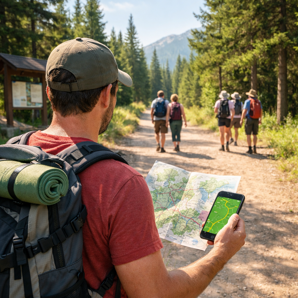
Download offline maps and organize documents
Cell service drops fast once you hit the gate. Download offline maps and the park’s app before you roll, and save Hiking Manual’s checklists locally; carry a paper map and printed confirmations as backup. Keep key documents in three places: phone (files/notes), cloud (drive), and in-pack pouch.
Micro-checklist
- Offline maps (park app + topo)
- PDF permits and campsite bookings
- Shuttle timetables and corridor windows
- Emergency contacts and medical info
- Road closure and fire alerts
Time your park visits for low-crowd windows
Arrive before sunrise to enjoy top overlooks in peace; most parks peak between roughly 9 a.m. and 4 p.m., according to Renee Roaming’s crowd-avoidance tips. Target marquee sights at dawn and dusk, then explore quieter districts or scenic drives midday.
Day-flow that works
- Pre-dawn entry, sunrise overlook
- 8–11 a.m. moderate or family-friendly hike
- Midday picnic, visitor center, or scenic drive
- 4–8 p.m. second hike and sunset view
Choose low-traffic trailheads and alternatives
Use park alerts, crowd maps, and ranger advice to find historically quieter corners. In Yellowstone, Old Faithful draws the largest crowds; nearby geyser basins can be far quieter, as noted in Trafalgar’s crowd-free park picks.
Some parks have reduced amenities—Arches removed select trash cans and picnic tables—so plan to pack out everything. Arches visitation also rose 74% from 2011 to 2021 (to 1.8 million), underscoring the need for a Plan B, according to Outside’s guide to crowded parks.
Like-for-like alternates
- Zion: Kolob Canyons viewpoints; Northgate Peaks via Kolob Terrace Road; East Mesa to Observation Point (check access); Watchman/Pa’rus at sunrise.
- Yosemite: Hetch Hetchy’s Wapama Falls; Sentinel Dome/Taft Point at dawn; Tuolumne’s Dog Lake and Lembert Dome when open.
- Grand Canyon (South Rim): South Kaibab to Ooh Aah/Cedar Ridge at sunrise; Grandview Trail early; Hermit Road overlooks after the shuttle rush.
- Yellowstone: Biscuit Basin and Black Sand Basin near Old Faithful; West Thumb Geyser Basin at dawn; Norris Geyser Basin loops early.
- Arches/Canyonlands: Tower Arch and Sand Dune Arch at first light; Canyonlands’ Whale Rock and Murphy Point for big views with fewer people.
Pack the Ten Essentials and safety extras
Follow the NPS Ten Essentials for day hikes—navigation, sun protection, insulation, illumination, first-aid, repair supplies, nutrition, hydration, and emergency shelter—and add extra water, Wag Bags, and a small emergency kit when services are reduced.
Build power and analog redundancy: a spare battery pack, paper map, and printed permits. If amenities are limited, bring a compact stove and microtrash container.
At-a-glance packing
- Navigation kit, sun gear, insulation, headlamp, first-aid, repair tape
- Extra water/electrolytes, high-calorie snacks, waste bags, microtrash container
- Spare tire kit, compact stove, compressible pillow; tire chains if applicable
Leave a trip plan and add buffer time
Tell a trusted contact your itinerary and expected check-ins, and use the NPS Trip Planning Guide template to document routes, contacts, and an Outdoor Emergency Plan. It’s a simple step that meaningfully reduces risk.
Add buffers for weather, construction, shuttle lines, and staffing gaps. Rule of thumb: 20% extra time per drive or hike, one zero-day per week, and plan sunset exits 60–90 minutes before dark.
Budget gear picks for crowd-smart travel
Value gear that’s comfortable, protective, and light helps you move earlier and faster at low-crowd windows. Prioritize quick-dry UPF layers and supportive footwear for long, mixed-surface days. For apparel ideas, see Hiking Manual’s roundups of hot-weather hiking shirts, lightweight hiking vests, and summer hiking pants, and browse Hiking Manual’s beginner-friendly lightweight hiking boots.
Footwear that stays comfortable all day
For long shuttle-to-trail days, pick cushioned, grippy options.
- NORTIV 8 budget hikers: solid toe protection and value
- Merrell Moab line: wide fit range and out-of-the-box comfort
- Saucony trail runners: quick-drying for lighter mileage days
Match outsole grip to your terrain (slickrock, sand, roots), consider wide sizes, and test-fit with the hiking socks you’ll wear.
Lightweight trekking poles for stability
Budget poles with quick-locks and tungsten-carbide tips deliver balance and knee relief.
- TREKOLOGY Trek-Z
- Cascade Mountain Tech
- TrailBuddy
Carry rubber tip covers for shuttle floors and boardwalks, use wrist straps correctly, and stow poles externally for quick transitions.
Weatherproof layers and sun protection
Pair a packable wind/rain shell with sun-smart layers: UPF shirts, breathable vests, and lightweight pants. Add a brimmed hat, polarized sunglasses, and mineral sunscreen for all-day UV defense.
- Explore Hiking Manual’s options: hot-weather hiking shirts, summer hiking vests, lightweight hiking pants.
Packs and organization for fast transitions
Choose an 18–28L daypack with a supportive hip belt, quick-access pockets, and stretch bottle sleeves. Add a small waist pack for permits/IDs.
Packing system
- Color-coded pouches by category
- Top-pocket speed kit: snacks, map, sunscreen, lip balm
- External stash for shell and wet gear
Regional route ideas with alternates
Always re-check timed-entry, sunrise passes, and parking rules before you go.
Sierra and desert loop
3–5 days. Catch Yosemite Valley sunrise viewpoints, then add Sequoia/Kings Canyon or eastern Sierra lakes. Yosemite won’t require vehicle reservations in 2026, but camps and trailhead parking still fill early—plan accordingly.
Desert add-on: Arches/Canyonlands. Arches runs timed entry April–October on a rolling basis and has seen major visitation growth; pack out trash where amenities are limited. Use nearby BLM/USFS dispersed camping as a pressure valve.
Sunrise/sunset picks: Tunnel View or Glacier Point at dawn; Moraine or Convict Lake sunsets; Arches’ Windows at first light.
Rockies and high-country circuit
3–5 days. Rocky Mountain National Park uses timed entry during set hours beginning May 22, 2026—book early and time sunrise arrivals. Use adjacent national forests for overflow camping.
Crowd-smart cadence: Dawn at Bear Lake corridor, midday stops along Trail Ridge Road, evening lakeside strolls. Add Great Sand Dunes at sunrise or late evening for firm, cool sand.
Pacific Northwest coastal and mountains
3–5 days. In Olympic, balance rainforest shade, alpine ridges, and tidepools. Secure food and scented items per park rules to avoid wildlife conflicts.
Sunrise/sunset picks: Hurricane Ridge at dawn; coastal tidepools at golden hour. For alternates and overflow, look to nearby national forests and DNR lands for dispersed or first-come camping.
Leave No Trace and food storage basics
Pack out all trash, especially where services are reduced. In parks like Arches with fewer bins and tables, self-sufficiency is part of the plan.
Follow park-specific food storage rules. In bear country, stash all food, trash, and scented items in approved lockers, canisters, or vehicles. Bear-safe storage prevents wildlife habituation, protects visitors, and helps avoid fines or campsite closures.
Frequently asked questions
Which parks use timed entry and how do I get permits?
Check each park’s official page for current rules, release windows, and any lotteries; use the permit quick-check in this Hiking Manual guide to start. Popular parks like Arches and Rocky Mountain often use timed-entry in summer—secure permits early and carry printed confirmations as backup.
How do I avoid crowds if I only have a weekend?
Arrive before sunrise, hit marquee viewpoints at dawn or dusk, and aim for quieter trailheads midday. Keep nearby national forests/BLM lands as flexible camping backups and build a simple Plan B list for each stop using the approach above.
What apps and maps should I use offline?
Download the park’s official app and your preferred navigation app, and save Hiking Manual’s checklists for offline use. Carry a paper map and printed permits, and save shuttle schedules and alerts locally in case service drops.
What are easy to moderate hikes that dodge crowds?
Look for rim, coastal, or outer-loop trails and start early; use the like-for-like alternates above as a model. Aim for 2–6 mile routes in quieter districts and avoid peak 9 a.m.–4 p.m. windows.
What should I book first for a peak-summer trip?
Reserve campsites and any required timed-entry or sunrise passes the moment release windows open, then lock in shuttles and transit. Set reminders for second-chance drops 30 and 5 days out, as noted in this Hiking Manual guide.