How to Check Seven Sisters Tide Times Safely Before Walking
How to Check Seven Sisters Tide Times Safely Before Walking
Planning a Seven Sisters walk? Tide timing is the single biggest safety factor if you’re considering beach or estuary sections. Here’s the fast process: pick the correct local tide station for Seven Sisters, read both times and heights for your date, convert to UK local time, cross‑check a second source, then add a conservative buffer so you’re off the beach well before high tide. On the day, recheck wind, swell, and access notices. If anything feels uncertain, default to the clifftop South Downs Way. The steps below show exactly how to check Seven Sisters tide times safely and turn the numbers into a go/no‑go plan. Hiking Manual’s approach is conservative by design—plan margins over speed.
Know the local hazards at Seven Sisters
The Cuckmere River mouth can run fast and deep on a rising tide, and high-water heights in this area commonly exceed 6 m on spring tides. Do not attempt to wade the estuary at or near high tide. Treat exits as potentially unreliable due to ongoing cliff erosion and occasional access closures such as steps and beach ladders being removed or shut for safety (see Seven Sisters National Park cliff safety). In an emergency, call 999 or 112 and ask for the Coastguard (see HM Coastguard safety advice).
Tidal range is the vertical difference between high tide and low tide at a location. Around the UK, the range changes across the monthly spring–neap cycle and between places, and can approach 10 metres in some estuaries. Bigger ranges drive faster currents and shrink safe beach windows.
Coastguard guidance in brief: check weather and tide times before you leave, aim to explore as the tide is going out, know your exit points, tell someone your plan, and carry a fully charged phone. These basics underpin Seven Sisters safety, especially near the Cuckmere Haven tide mouth, cliff erosion zones, and Birling Gap access points.
Step 1: Identify the correct tide location and station
Get location‑specific data so you’re not relying on a distant harbour’s timings. Many services label the local station for Seven Sisters as “Nags Head” or use the nearest derived station. That’s fine—but local conditions can diverge slightly from a primary port.
Reliable examples:
- Windfinder tide calendar for Seven Sisters (Nags Head): 10‑day predictions with station notes (Windfinder tide calendar for Seven Sisters (Nags Head)).
- Tide Guide app: live charts and height predictions, with long‑range look‑ahead up to a year (Tide Guide app).
- A general tide calendar that shows time and height together, useful for learning the format (Seven Sisters tide table).
“Tide predictions are astronomical estimates based on the gravitational pull of the moon and sun and are guidance, not guarantees, because weather and local effects can shift actual water levels.” Windfinder highlights this distinction on its tide pages.
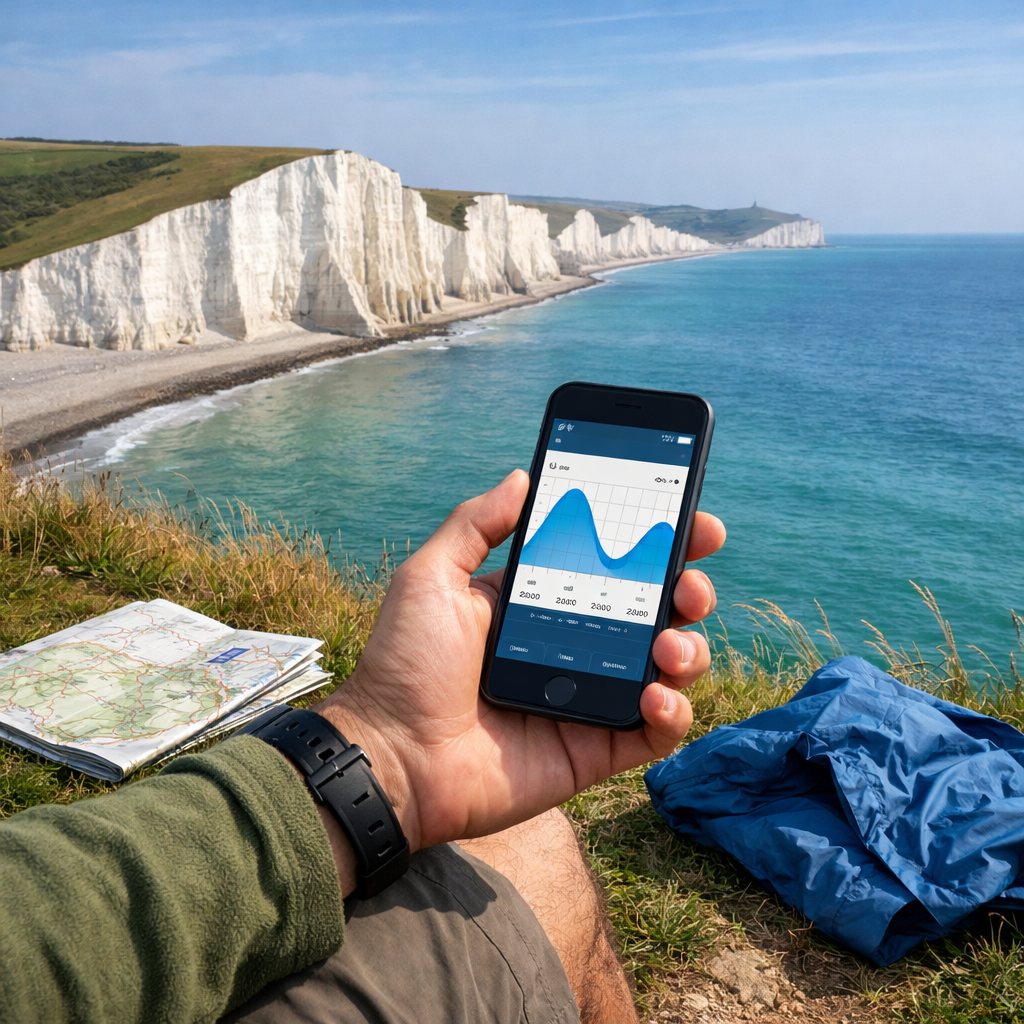
Step 2: Check tide times and heights for your date
Don’t just note the clock times—log the heights too. Higher highs mean narrower beaches and stronger currents near constrictions like the Cuckmere mouth; lower lows mean a wider window beneath the cliffs.
Use a simple planning layout:
- Date | High tide time/height | Low tide time/height | Notes (planned start/turn‑around)
Example (format only; not for navigation):
- 12 Aug | High 01:33 6.25 m | Low 07:42 −0.18 m | Start after low, off beach by buffer before next high
Tide services present values like the example above so you can see both time and height at a glance (Seven Sisters tide table). Remember: predictions are provided without warranty and are not for navigation. Treat high tide safety, low tide windows, and tide height together when planning.
Step 3: Convert to local time and note spring or neap tides
Make sure the times are in UK local time—GMT in winter, BST in summer—and account for clock changes in late March and late October. Some apps default to UTC or your phone’s region; double‑check settings.
Spring vs. neap in brief: Spring tides happen near new and full moon, when lunar and solar gravity align to produce larger tidal ranges and stronger currents. Neap tides occur near first and third quarter, when forces partially cancel, giving smaller ranges. This spring–neap cycle repeats roughly every 14 days (beginner’s guide to understanding tides).
Recommendation: increase safety margins during spring tides and when onshore winds are forecast. Schedule any beach segments for a falling tide.
Step 4: Cross-check two reliable tide sources
Before you lock your plan, compare at least two services (e.g., Windfinder’s Nags Head station vs. a dedicated tide app like Tide Guide) to catch station or datum differences.
Quick reconciliation:
- If times differ by more than ~15 minutes or heights differ notably, default to the more conservative reading (earlier high tide, higher high‑water).
- Confirm you’re looking at the same station name and datum.
- When in doubt, add extra buffer. Predictions guide you, but weather can shift actual levels.
Step 5: Set a safety buffer around high tide
Turn predictions into ground truth with a hard buffer:
- Be off the beach at least 1 hour before predicted high tide.
- Extend to 90–120 minutes during spring tides or strong onshore winds.
- Avoid estuary crossings except close to low or slack water, and only if a safe line is known.
Slack water is the short period around high or low tide when the current slows before reversing; it can make crossings less hazardous but channels and mud remain dangerous—avoid estuary wades unless you have a known safe line.
Steps:
- Identify the next high tide time/height for your route section.
- Plan to complete beach parts well before that time; set alarms.
- If exits are uncertain, switch to the clifftop South Downs Way. These buffers are standard in Hiking Manual route planning.
Step 6: Check weather, waves, and local access notices on the day
Recheck the forecast before you leave and again at the coast. Strong onshore wind and low pressure can raise water levels above predictions and shorten safe windows; the Coastguard advises exploring as the tide is going out and knowing your exits. Verify on‑site signage and any closures—Birling Gap steps are periodically closed or removed due to erosion, and cliff falls on soft chalk are unpredictable (Explore Seven Sisters access and visitor info).
Pre‑walk checklist:
- Tide recheck + buffer confirmed
- Wind direction and swell glance
- Access notices at Birling Gap and Cuckmere
- Emergency plan and charged phone
Plan your route choice with tides in mind
If tides or weather don’t line up, default to the clifftop South Downs Way. Keep beach options for falling/low‑tide windows with multiple known exits.
For the classic Seaford–Eastbourne traverse, allow roughly 14 miles and 6–7 hours at a steady pace; plan so any shoreline segments land squarely within the safe window (Hiking Manual’s Seven Sisters Cliffs walk guide). Build detours if the Cuckmere cannot be crossed safely. Don’t shortcut along unstable cliff bases, stay well back from edges, and heed erosion warnings.
Safe timing for Cuckmere Haven and cliff base options
- Cuckmere crossing: In some conditions around low or slack water, a shallow wade near the river mouth is possible; at high tide, use the bridge. The shortcut can save about 50 minutes and nearly 2 miles, but only attempt near low/slack water when locally safe (Hiking Manual’s Seven Sisters Cliffs walk guide).
- Cliff‑base walking: Attempt only on a falling tide with multiple open exits. Rising water can trap you, and cliff falls remain unpredictable.
Decision guide:
- Tide falling and >2 hours to low: Short beach segment may be feasible if exits are open.
- Near low/slack water: Best window for any cautious Cuckmere wade if locally safe.
- Tide rising or <1 hour to high: Avoid beach/estuary; use clifftop path.
What to do if conditions change or you are cut off
If trapped by the tide, move to the highest safe ground, stay well away from cliff bases and edges, and call 999 or 112 asking for the Coastguard. Keep your phone on, visible if directed, and follow instructions. Currents at the Cuckmere mouth are strong at high tide—do not attempt to swim across. Tell someone your plan before setting out and carry a whistle or bright layer to aid visibility.
Offline navigation and safety kit recommendations
Download the route and exits to Komoot for offline, turn‑by‑turn navigation, and carry OS Map OL25 as a paper backup. Mobile signal can be patchy on the coast.
Compact safety kit:
- Fully charged phone + small power bank; whistle; compact first‑aid kit
- Warm layers, windproof/waterproof shell, water, high‑energy snacks
- Paper map and compass; facilities are limited along much of the route
Budget gear for exposed coastal walking
- Footwear/clothing: Choose grippy soles for chalk and mud, a windproof layer, and a light waterproof. Pack a beanie and gloves year‑round—wind chill on the cliffs is real.
- Entry‑level trekking poles: TrailBuddy, TREKOLOGY Trek‑Z, or Cascade Mountain Tech add stability on steep chalk undulations and near exposed edges.
- Beginner backpacks: Loowoko or Bseash for day‑hike loads; SKYSPER 10L for minimalist setups.
- Affordable tents (multi‑day): Kelty Grand Mesa 2P, Forceatt, UNP, or FanttikOutdoor Zeta C6 Pro. Use pack covers or dry bags to protect from salt spray and showers.
Frequently asked questions
What is the safest tide window for walking below the cliffs?
Aim for two hours either side of low tide and be off the beach at least one hour before the next high. Hiking Manual recommends extending the buffer during spring tides or if onshore winds are forecast.
Which tide apps or sites should I use for Seven Sisters?
Use a local station listing (e.g., Seven Sisters/Nags Head) and cross‑check with a second, independent tide source. Hiking Manual compares both time and height, then plans conservatively.
How do wind and pressure change actual tide levels?
Strong onshore wind and low pressure can raise water levels above predictions, narrowing beaches earlier than expected. Treat tables as guidance and add extra buffer in rough forecasts.
Can I cross the Cuckmere River at low tide?
Sometimes—local conditions may allow a shallow wade near low or slack water. If the tide is high or the flow looks strong, use the bridge; never gamble an estuary crossing.
What if the Birling Gap steps or exits are closed?
Switch to the clifftop South Downs Way and avoid beach sections. Follow on‑site signage and never rely on a single exit when the tide is rising.