Best Seven Sisters Weather Apps for Hikers in 2026
Best Seven Sisters Weather Apps for Hikers in 2026
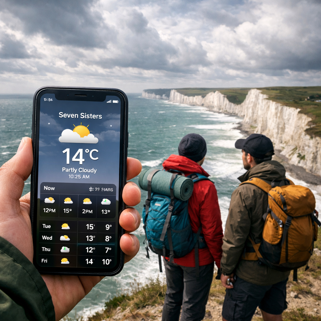
Seven Sisters weather changes fast: Atlantic fronts, sea-breeze shifts, and cliff-top exposure make a coastal wind forecast, hyperlocal radar, and minute-level nowcasts essential for safe, enjoyable day hikes. The best Seven Sisters weather app for hikers is a duo: a precise nowcast app for rain timing plus a speedy radar app to track squalls in real time. Check forecasts before you leave, save screenshots for signal-free sections, and keep offline maps handy for UK hiking weather along the coast.
“Nowcasting and hyperlocal radar” in 48 words: minute‑by‑minute precipitation estimates combined with live, high‑resolution radar and short‑term models to forecast the next 0–2 hours at neighborhood scale. AccuWeather’s MinuteCast exemplifies this approach and is often cited near 95% for 24‑hour accuracy, while Which? ranked The Weather Channel most accurate in UK tests, with AccuWeather close behind (AccuWeather context, Which? UK accuracy).
Hiking Manual’s POV: for exposed ridgelines, pair a radar app with a nowcast/forecast app; cross‑check before committing to cliff‑top sections (supported by Which? testing).
How to choose a Seven Sisters weather app
Focus on safety-critical details for coastal hiking rather than flashy extras. Prioritize:
- Minute-by-minute precipitation nowcasts for shower timing
- Reliable radar animation with motion loops and precipitation type
- Wind speed and gusts on cliffs, plus visibility/fog
- Severe weather and lightning alerts you can customize
Nowcast, in 46 words: a very short‑term forecast (generally 0–2 hours) blending recent radar, satellite, ground sensors, and high‑frequency models to predict precipitation onset, intensity, and duration at street‑to‑neighborhood scale. AccuWeather’s MinuteCast is a well‑known implementation and is designed to time rain to the minute.
Accuracy: Which? testing found The Weather Channel most accurate overall in UK trials, with AccuWeather second. They also note probability of precipitation can be overstated (for example, 17% predicted vs 12% measured), so interpret PoP as a risk range, not a guarantee (source: Which? UK accuracy).
Practical setup:
- Test two apps locally for a week to learn their bias.
- Enable severe and lightning alerts.
- Before hiking, download screenshots of hourly and radar loops and save offline maps in your navigation app.
What hikers need at Seven Sisters
Seven Sisters’ chalk cliffs are fully exposed to Channel winds, with fast‑moving squalls and low cloud/fog that can cut visibility. That means you need:
- Coastal wind/gust forecasts to judge balance and wind chill on cliff‑top paths
- Precipitation timing to avoid heavy showers on exposed sections
- Fog/visibility cues for safe navigation near edges
- Fast radar to watch squall lines coming off the Channel
Radar-focused apps like MyRadar and NOAA‑style viewers excel at speed and storm tracking, while Windy stands out for multi‑layer map visualizations of wind, rain, and storm motion (see reviews in apps roundups like Weather on the Way’s 2026 guide).
Hyperlocal data, in 45 words: site‑specific observations from dense personal weather station networks that refine model forecasts near where you hike. Weather Underground aggregates more than 250,000 stations worldwide, providing neighborhood‑level temperature, wind, and precipitation readings—coverage varies outside urban areas, so always validate against a model‑driven app (source cited above).
Gear readiness matters on windy coasts: waterproof hiking shoes for sudden showers, thermal base layers and fleece midlayers for wind chill, and touchscreen‑compatible insulated gloves for cold gusts. If you plan winter bivvies, consider robust 4‑season tents with stove jack options to manage condensation and warmth.
Comparison criteria
We ranked apps using:
- Short‑range accuracy and nowcasts
- Radar quality, speed, and precipitation type
- Wind layers and gusts, including coastal effects
- Alerts (severe, lightning, custom thresholds)
- Offline usability (caching/screenshots)
- Price/value
- Ease of use
Note: premium tiers often unlock higher‑resolution updates and faster refresh (e.g., Windy premium adds high‑res models and hourly intervals; see 2026 app comparisons from Weather on the Way).
What resolution means: the spatial grid size of a forecast model; smaller grid cells capture more local detail. As an orientation point, the Meteoblue NEMS4 model runs at roughly 4 km resolution, illustrating the value of finer‑scale guidance over complex coastlines (see Meteomatics’ model overview).
Refresh frequency matters: top apps update core layers every 15–60 minutes; faster refresh is better for squall‑prone coasts (see Weatherstack’s roundup on accuracy and update cadence).
Hiking Manual
Hiking Manual is built for practical, beginner‑friendly decisions: we translate tricky weather features into simple route and gear choices, with an eye on budget and safety. Our guides include quick pre‑hike weather checks you can run in a minute. For navigation, see our guide to GPS/offline options in Best Hiking GPS Watches for Navigation, and explore layered coastal clothing advice on Hiking Manual.
AccuWeather
AccuWeather is excellent for Seven Sisters day hikes thanks to MinuteCast, which provides minute‑by‑minute precipitation timing and robust severe weather alerts. It’s widely cited for strong short‑term accuracy, with some sources referencing near‑95% accuracy over 24 hours, and remains a common hiker pick (context linked above). Premium tiers typically run about $2–$4/month and reduce ads while adding features like extended hourly detail (pricing ranges referenced in Android app roundups).
Pros:
- Minute‑level rain timing that’s ideal for choosing when to commit to exposed cliff sections
- Solid severe and lightning alerting
Cons:
- Ads and some features behind the paywall
- Interface can feel busy
Tip: check MinuteCast before you leave Birling Gap or Cuckmere Haven; pair with a dedicated radar app to watch incoming squalls.
Windy
Windy is the best visual tool for wind and storm evolution, showing animated wind, rain, and cloud layers from multiple global and regional models. Along this coast, the gust layer and wind at 10 m are crucial for cliff‑top comfort and safety. Windy Premium (about $18.99/year) unlocks faster updates, hourly intervals, and higher‑resolution models (noted in 2026 app reviews).
How to use Windy at Seven Sisters:
- Turn on the gust layer to spot dangerous peaks.
- Use meteograms for hour‑by‑hour wind shifts and precipitation.
- Animate the radar/satellite blend to gauge squall timing.
Suggested layers for Seven Sisters:
| Layer | Why enable it |
|---|---|
| Wind | Baseline speed to judge comfort on exposed paths |
| Gusts | Identify brief, hazardous peaks that affect balance |
| Rain radar | Track shower bands moving along the Channel |
| Waves/swell | Useful context for sea‑spray and coastal exposure near the beach |
Caveat: the data‑rich interface can overwhelm new users—save a preset with only the layers above.
Tomorrow.io
Tomorrow.io focuses on micro‑forecasting: very short‑term, neighborhood‑scale predictions that capture rapid changes in precipitation, wind shifts, and visibility—ideal for deciding whether to pause or push to the next headland. The platform layers AI‑driven forecasts on top of dense data sources and also offers a deep API used by mobility and outdoor apps (covered in reviews of leading weather APIs).
Use it to:
- Check minute‑level precipitation and gust spikes before ridge segments
- Set focused alerts for wind direction changes that impact wind chill
Note: some premium features may require a subscription.
Micro‑forecast, in 45 words: a hyper‑short‑term prediction focused on the next minutes to couple of hours across a small area, using high‑frequency observations, radar, and rapid‑update models. It is designed for “go/no‑go” decisions on exposed terrain where conditions can change between waypoints.
Weather Underground
Weather Underground shines where personal weather stations are nearby—often around trailheads, car parks, and towns bordering the South Downs. With more than 250k personal stations globally, it can deliver hyperlocal readings for temperature, wind, and rain, though coverage thins between villages along the cliffs. An ad‑free plan typically runs about $3.99/month or $20/year, and reviewers often note a stronger privacy stance than some rivals (summarized in independent app roundups).
Tip: cross‑check a local station’s wind and rain with a model‑based app (Windy/AccuWeather) to filter out sensor quirks.
CARROT Weather
CARROT Weather is ideal for power users who want granular alerts, rich widgets, and multiple data sources in one place. Create custom alert rules (for example, wind >30 mph, gusts >40 mph, rain onset, lightning within 10 miles) and tune the app’s famously snarky UI to “professional” mode. Many advanced features sit behind paid tiers (often from roughly $4.99/month), with extensive customization praised in expert app reviews like PCMag’s best weather apps.
Best for hikers who want deep, configurable alerts at‑a‑glance on watch and phone.
MyRadar
MyRadar is the quickest way to see what’s coming off the Channel. It launches straight into a fast radar loop with optional storm tracking—perfect for spotting squall lines and timing a break or a cliff‑top push. Paid tiers add extras such as CarPlay support for drive‑to trailheads on changeable days (features highlighted in Android weather app roundups).
Practical radar workflow:
- Open radar and set a 30–60 minute loop.
- Note motion and speed of incoming bands.
- Check precipitation type and intensity.
- Confirm timing with your nowcast app.
- Decide whether to pause at a sheltered point or proceed on exposed sections.
Yr.no
Yr.no provides straightforward, reliable hourly forecasts worldwide, making it a solid planning baseline for Seven Sisters. Use it to see 24–48‑hour trends for wind shifts and rain windows, then verify with a radar loop before hiking.
Pros:
- Clean interface and useful hourly trend lines
- Works globally with consistent presentation
Cons:
- Fewer advanced layers than pro‑focused apps
- Lacks granular customization and power‑user alerts
Head-to-head comparison
| App | Data strengths | Alerts depth | Offline help | Typical refresh | Price snapshot |
|---|---|---|---|---|---|
| AccuWeather | Minute‑by‑minute nowcast; solid hourly | Severe, lightning, customizable | Cached last view; screenshots | 15–60 min | ~$2–$4/mo premium |
| Windy | Wind/gust layers; model choice; radar/sat blend | Basic notifications; premium speeds | Limited; save views/screens | Hourly; faster with premium | ~$18.99/yr premium |
| Tomorrow.io | Micro‑forecasts; granular layers | Rich, scenario‑based | Cached basics | Frequent short‑term updates | Tiered; some features paid |
| Weather Underground | Hyperlocal PWS observations | Standard alerts | Cached last obs; screenshots | Station‑dependent | ~$3.99/mo ad‑free |
| CARROT Weather | Custom rules, widgets, multi‑sources | Highly customizable | Widgets persist; screenshots | Source‑dependent | ~$4.99+/mo |
| MyRadar | Fast radar loop; storm tracking | Severe overlays; some notifications | Cached tiles | Minutes‑level radar pulls | Free + paid add‑ons |
| Yr.no | Clean hourly/global coverage | Standard | Screenshots | Hourly | Free |
Independent UK tests have placed The Weather Channel and AccuWeather at or near the top for short‑term accuracy; for hiking, pairing radar + nowcast remains the safest strategy in squall‑prone coasts (see Which?).
Apps commonly refresh core data every 15–60 minutes; faster refresh improves decisions near the cliffs (see Weatherstack on update cadence).
Pricing and value
Typical prices and what you get:
- AccuWeather: about $2–$4/month; removes ads, adds extended hourly detail.
- Weather Underground: about $3.99/month or $20/year; ad‑free and cleaner PWS browsing.
- Windy Premium: roughly $18.99/year; faster updates, hourly intervals, higher‑res models.
- CARROT Weather: from about $4.99/month; deep customization, widgets, and advanced alerts.
Budget bundles:
- Free forecast app (Yr.no or AccuWeather free) + free radar (MyRadar) = zero‑cost, high‑utility combo.
- One premium subscription (Windy or CARROT) if you hike weekly and want faster updates/alerts.
Best value for:
- Occasional day hikers: Yr.no + MyRadar.
- Frequent walkers: AccuWeather premium + MyRadar.
- Winter coastal hikers: Windy Premium for gust detail + CARROT for custom high‑wind/lightning alerts.
Recommendations by use case
- Best overall for Seven Sisters day hikes: AccuWeather (nowcast) + MyRadar (radar).
- Best for wind planning: Windy (gusts, hourly premium).
- Best near trailheads with stations: Weather Underground.
- Best for power users and custom alerts: CARROT Weather.
- Best simple hourly planner: Yr.no.
Gear prompts:
- Strong winds: thermal base layers, fleece midlayer, touchscreen‑compatible insulated gloves.
- Wet forecasts: waterproof hiking shoes and pack covers; consider a windproof shell.
- Overnight in cold seasons: robust 4‑season tents with stove jack options, and always pack a warm hat.
Safety tips and offline planning
Pre‑hike flow for coastal safety:
- Check a 48‑hour trend (Yr.no/Windy).
- Confirm the morning nowcast (AccuWeather).
- Review a 30–60 minute radar loop (MyRadar).
- Set severe/lightning/high‑wind alerts (CARROT/AccuWeather).
- Download offline maps or save screenshots for signal‑poor stretches. Using two complementary apps and enabling severe/lightning alerts is best practice (reinforced by Which? testing).
Severe weather alert, in 48 words: a push notification triggered by official or app‑determined thresholds for hazardous conditions such as lightning, thunderstorms, high winds, and coastal squalls. Coupled with NOAA‑style radar and storm tracking, these alerts give hikers time to delay exposed sections, seek shelter, or reroute to safer terrain.
Clothing and planning reminders: layer up for wind chill with thermal base layers and a fleece midlayer under a windproof shell; keep waterproof hiking shoes ready for slick chalk paths. For navigation without service, rely on offline map apps or GPS watches.
Frequently asked questions
Which app provides weather forecasts specific to the Seven Sisters area
Use a minute‑by‑minute nowcast paired with a fast radar viewer; cross‑check wind layers before committing to cliffs. Hiking Manual recommends this combo for local timing and wind context.
How accurate are nowcasts and radar near the cliffs
They’re strong for short‑term precipitation timing and show squall movement clearly. Hiking Manual advises verifying with a fresh radar loop before exposed sections.
Do these apps work offline on coastal sections
Most weather data requires signal, so check forecasts and save screenshots before you start. Hiking Manual suggests carrying offline maps and refreshing weather at signal points.
What alerts should I enable for exposed ridgelines
Enable severe weather, lightning, high wind, and precipitation start alerts, with custom gust thresholds around 35–40 mph. Hiking Manual prioritizes alerts that help you delay cliff‑top sections or reroute.
How should I combine a weather app with a hiking map app
Check a 48‑hour trend and morning nowcast, then review a 30–60 minute radar loop before you go. Navigate with an offline map and re‑check weather at signal points—Hiking Manual’s pre‑hike flow follows this sequence.