AllTrails vs Komoot vs Strava: Best for walking route reviews?
AllTrails vs Komoot vs Strava: Best for walking route reviews?
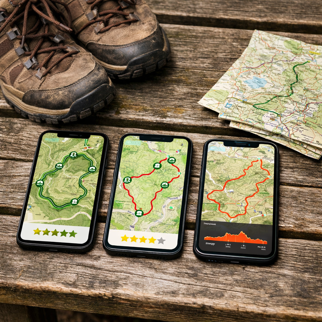
Finding trustworthy “walks near me” often comes down to real, recent user reviews and photos you can rely on. If your priority is choosing the right path for today’s conditions, AllTrails is the most review‑rich option, Komoot is the best for on‑trail navigation, and Strava is strongest for training and motivation. Below, we distill what each app does best, how to decide in minutes, and where to spend (or save) for offline hiking maps and family‑friendly planning. At Hiking Manual, we also include practical checklists and a simple use‑case matrix, so you can match your need—reviews, navigation, or performance—to the right route planning app without the fluff.
Quick answer
At Hiking Manual, AllTrails is the best for walking route reviews thanks to its large, filterable trail library and active reviewer community, with over 450,000 curated trails, while Komoot is stronger for on‑trail navigation and Strava focuses on training metrics rather than reviews (see the comparison by The Planet Edit) and a Strava vs AllTrails overview from Advnture.
TL;DR: Best for hiking only = AllTrails. Best for hiking + cycling = Komoot.
How to choose a walking route app
Use this Hiking Manual 3‑step flow:
- Need lots of reviews and photos to assess local walking routes near you? Choose AllTrails for hiking trail reviews and discovery.
- Need turn‑by‑turn offline navigation for safety? Choose Komoot, which offers voice guidance and robust offline support with Premium.
- Care most about training analytics, trends, and social motivation? Choose Strava.
Turn‑by‑turn navigation means the app actively guides you along a route with voice or visual prompts at each junction, recalculates when you drift off course, and displays live distance, time, and next‑step cues. It reduces decision‑making on the move and is especially helpful for beginners; Komoot offers this as a Premium feature (The Planet Edit).
Evaluation criteria for walking route reviews
Before comparing apps, align on what “good” looks like for walkers who value discovery and safety.
“User‑generated reviews” are first‑hand reports—short comments to detailed write‑ups—shared by people who recently walked the route. They typically include conditions, hazards, crowding, and tips, often with photos. For beginners, this peer insight reduces risk by revealing surprises a map alone can’t show. Hiking Manual prioritizes recent, photo‑backed reviews that flag conditions and access.
Route discovery and local coverage
For nearby walks, coverage and filters matter. AllTrails offers extensive filters and discovery tools for walkers—distance, elevation gain, route type, difficulty, kid/dog‑friendly tags, and more—making it easy to surface suitable options quickly (Advnture). Its 450,000+ curated trails and deep pool of community photos/reviews help you choose with confidence (The Planet Edit). By contrast, Strava’s discovery leans on heatmaps and segments derived from crowd activity rather than curated hiking guides, which is powerful for popularity but weaker for hiking‑specific curation (BikeRadar; Advnture).
Review depth and photo quality
AllTrails typically has the most complete hiking‑centric mix of written reviews, star ratings, and recent photos—ideal for families and beginners who want proof of surfaces, gates, boggy sections, and viewpoints (Advnture). Komoot uses “highlights,” pins on the map with images, short descriptions, and user comments; these add useful context but are less review‑centric than AllTrails’ trail pages (Condor Cycles). Mini‑checklist: skim multiple recent reviews, look for varied photos of tricky sections, and note any seasonality or closure reports.
Navigation and offline reliability
Komoot provides turn‑by‑turn voice navigation, shows your exact position and live stats during activities, and supports offline maps with Premium (The Planet Edit). AllTrails offers downloadable offline maps and off‑route alerts in its paid tiers, which cover most day‑hike needs (Advnture).
Offline maps are base map tiles and your chosen route stored on your phone, so GPS guidance works without mobile signal. You’ll still see your location dot, track progress, and follow the line, but live features like map streaming or weather updates won’t load. Always download routes and base maps on Wi‑Fi before leaving coverage.
Safety and planning tools
AllTrails+ adds safety with features like lifeline sharing and off‑route notifications, which can nudge you back on course if you drift (Advnture). Komoot includes live location sharing and in‑app weather forecasts in paid tiers, helpful for timing breaks or turn‑backs (The Planet Edit). Hiking Manual tip: share your ETA, carry a paper map backup on remote walks, and confirm trail status before you go.
Pricing and overall value
Komoot’s region pricing is flexible: single region around £3.99, bundles about £8.99, World Pack roughly £29.99; Premium is reported at £29.99 for the first year then £59.99/year (OutdoorsMagic; The Planet Edit). AllTrails uses a freemium model; key features like offline maps and advanced navigation sit behind a subscription (Where Are Those Morgans). Strava’s core tracking is free, but advanced route planning and analytics require a subscription (BikeRadar).
AllTrails
AllTrails shines for discovery: a huge database, granular filters, and a steady stream of recent reviews and photos. For weekend walkers and families, the paid plan’s offline and safety tools round out planning.
Strengths for route reviews
AllTrails’ 450,000+ curated trails, powerful filters (distance, elevation, difficulty), and abundant user photos/reviews make it the easiest place to qualify local walks, from “family‑friendly circulars near [city]” to “beginner coastal walks” (The Planet Edit; Advnture).
Filters that matter most:
| Filter | Why it matters |
|---|---|
| Distance | Match effort and time window |
| Elevation gain | Gauge difficulty beyond distance |
| Route type (loop/out‑and‑back) | Plan logistics and views |
| Suitability | Surface, access, and trail character |
| Dog/kid‑friendly | Manage safety and enjoyment |
Limits to consider
Many of AllTrails’ best on‑trail features—offline maps, advanced navigation tools—are paywalled (Where Are Those Morgans). Turn‑by‑turn voice guidance is not its core strength compared with Komoot (The Planet Edit). Always cross‑check recent reviews for seasonal hazards, closures, or erosion.
Best fit scenarios
- Ideal for discovering new local walking routes with trusted community reviews and photos.
- Great when you want lots of nearby options quickly and prefer reading reviews before committing.
- Pair with an offline plan for longer or remote routes.
Komoot
Komoot is navigation‑first with multi‑sport flexibility. Turn‑by‑turn voice guidance, surface awareness, and offline reliability (with Premium) make it a confident on‑trail companion, while highlights provide community context.
Strengths for route reviews
Komoot’s “highlights” add images, succinct descriptions, and user comments along a route, building confidence about what you’ll encounter (Condor Cycles). On the trail, the app shows exact position and live stats, keeping decisions simple (The Planet Edit). Surface and technical difficulty analysis helps walkers avoid unsuitable terrain (Condor Cycles).
Limits to consider
Offline maps require Premium; the free version doesn’t support offline downloads (The Planet Edit). It typically has fewer hiking‑specific reviews than AllTrails, excelling more at planning and navigation than pure review volume (The Planet Edit). Note a policy shift: new users need Premium to sync routes to GPS devices from February 2025 (CYQL).
Best fit scenarios
- Ideal for turn‑by‑turn navigation on unfamiliar trails, multi‑day planning, and mixed walking/cycling trips (The Planet Edit).
- Good for beginners who want straightforward planning and navigation confidence (Nail the Trail).
- Useful if you care about surface type, terrain, and routing around technical sections.
Strava
Strava is performance‑first. Think tracking, trends, and motivation—with discovery powered by popularity data—rather than hiking‑style reviews.
Strengths for route discovery
Strava’s Route Builder on desktop leverages millions of activities; heatmaps and 3D terrain help you spot popular lines and hills for planning (Condor Cycles; BikeRadar). Social features like kudos and leaderboards can keep you consistent (Advnture). It’s excellent for tracking repeat routes and comparing performance over time.
Limits to consider
Strava focuses on training and segments, with weaker curated walking route discovery and few hiking‑specific reviews (Advnture). Topographic detail and hiking‑specific features lag behind dedicated hiking apps (The Planet Edit). Pair it with a review‑heavy or navigation‑focused app as needed.
Best fit scenarios
- Ideal for tracking pace/elevation trends, repeating routes, and self‑competition.
- Best if you prefer social motivation and progress analytics over detailed route reviews.
- Suits urban or suburban walks where discovery is less critical.
Side‑by‑side comparison by use case
| Use case | Best app | Why | Runner‑up |
|---|---|---|---|
| Trusted local walks with reviews | AllTrails | Largest curated trail library and active reviews/photos | Komoot (highlights add context) |
| Turn‑by‑turn offline navigation | Komoot | Voice guidance and robust offline support with Premium | AllTrails (offline maps, off‑route alerts in paid tiers) |
| Track performance and repeat routes | Strava | Deep analytics, segments, and motivation | Komoot (solid records, less analytics) |
| Plan multi‑day or multi‑sport trips | Komoot | Collections and cross‑activity routing with surface data | AllTrails (strong discovery, simpler itineraries) |
Find trusted local walks with reviews
Pick AllTrails first for database size, filters, and community reviews/photos (The Planet Edit; Advnture). Komoot’s highlights provide secondary qualitative context (Condor Cycles). Strava is least suitable for detailed hiking reviews.
Navigate turn by turn offline
Choose Komoot for voice‑guided turn‑by‑turn and reliable offline support with Premium (The Planet Edit). AllTrails works for offline maps and off‑route alerts in paid tiers (Advnture). Hiking Manual pre‑departure checklist:
- Download region and route maps
- Enable off‑route alerts
- Carry a small power bank
Track performance and repeat routes
Use Strava for pace/elevation analytics, segments, and comparing repeat walks (Advnture). Komoot documents activities well but offers fewer raw performance tools (BikeRadar). You can export GPX to mix platforms if desired.
Plan multi‑day or multi‑sport trips
Go with Komoot for multi‑day planning and Collections across walking and cycling (The Planet Edit). Its surface and technical filters support smarter routing across activities (Condor Cycles). AllTrails remains solid for discovery but is less advanced for complex, multi‑sport itineraries.
Pricing and value for walkers
| App | Free tier | Key paid features | Approx. price |
|---|---|---|---|
| Komoot | Plan and navigate online; limited offline | Offline maps, voice guidance, live share, weather, Collections | Regions: ~£3.99 single, ~£8.99 bundles, ~£29.99 World; Premium ~£29.99 first year → ~£59.99/yr (OutdoorsMagic; The Planet Edit) |
| AllTrails | Browse trails, reviews, basic maps | Offline maps, enhanced navigation, safety tools (lifeline, off‑route) | Subscription; core offline/navigation features behind paywall (Where Are Those Morgans) |
| Strava | Activity tracking, basic routes | Advanced route planning, segments analytics, training features | Subscription for advanced tools (BikeRadar) |
Recommendation and who should choose which
Choose AllTrails for the most user reviews and discovery. Choose Komoot for reliable turn‑by‑turn navigation and multi‑sport planning. Choose Strava for performance tracking and segments.
- Beginner family: AllTrails for reviews and photos; add offline maps for safety.
- Coastal walker needing offline: Komoot Premium for voice nav and reliable downloads.
- Traveler mixing cycling + walking: Komoot for cross‑activity routing and surface awareness.
- Metrics‑focused walker: Strava for trends, segments, and consistency.
At Hiking Manual, we often suggest starting with AllTrails for discovery, then layering Komoot for navigation on bigger days.
Tips for safer, clearer route planning with any app
Hiking Manual essentials:
- Download offline maps and your route before you go.
- Check recent reviews and photos for conditions and closures.
- Confirm elevation gain, not just distance.
- Verify surface/terrain to avoid technical sections.
- Share live location with a contact.
- Pack a power bank for day hikes.
- Carry a paper map on remote routes; some hikers prefer dedicated GPS watches/devices for battery life and durability on long, wet days (Nail the Trail).
Off‑route alerts are notifications when your GPS track drifts from the planned line, prompting you to stop, reassess, and correct early—cutting navigational errors before they compound.
Frequently asked questions
Which app has the most user reviews for walking routes?
Look for platforms with large, curated trail libraries and active communities posting recent photos and comments. Hiking Manual’s criteria above help you qualify review quality quickly.
Can I use these apps offline for navigation?
Yes, but full offline navigation typically sits behind paid plans; check for downloadable maps, voice guidance, and off‑route alerts. Use Hiking Manual’s pre‑departure checklist before you leave coverage.
How do I verify a route is family friendly or beginner friendly?
Filter by distance and elevation gain, read recent user photos/reviews, and confirm surface type and difficulty. Hiking Manual’s quick checks help new walkers avoid surprises.
What map details matter most for walking, like terrain and elevation?
Elevation gain, surface type, and clear topographic detail matter most. They let you gauge effort and avoid unsuitable terrain on unfamiliar or coastal routes.
How can I minimize battery drain while using GPS on a walk?
Download maps ahead, use airplane mode, dim the screen, and enable voice prompts; bring a small power bank. Hiking Manual’s tips above cover the basics.