Trusted Outdoor Brands for Weatherproof Women’s Jackets, Editor-Tested Picks
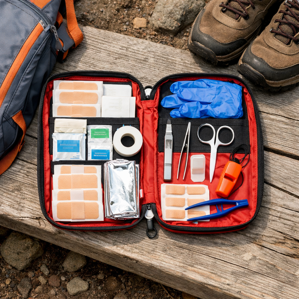
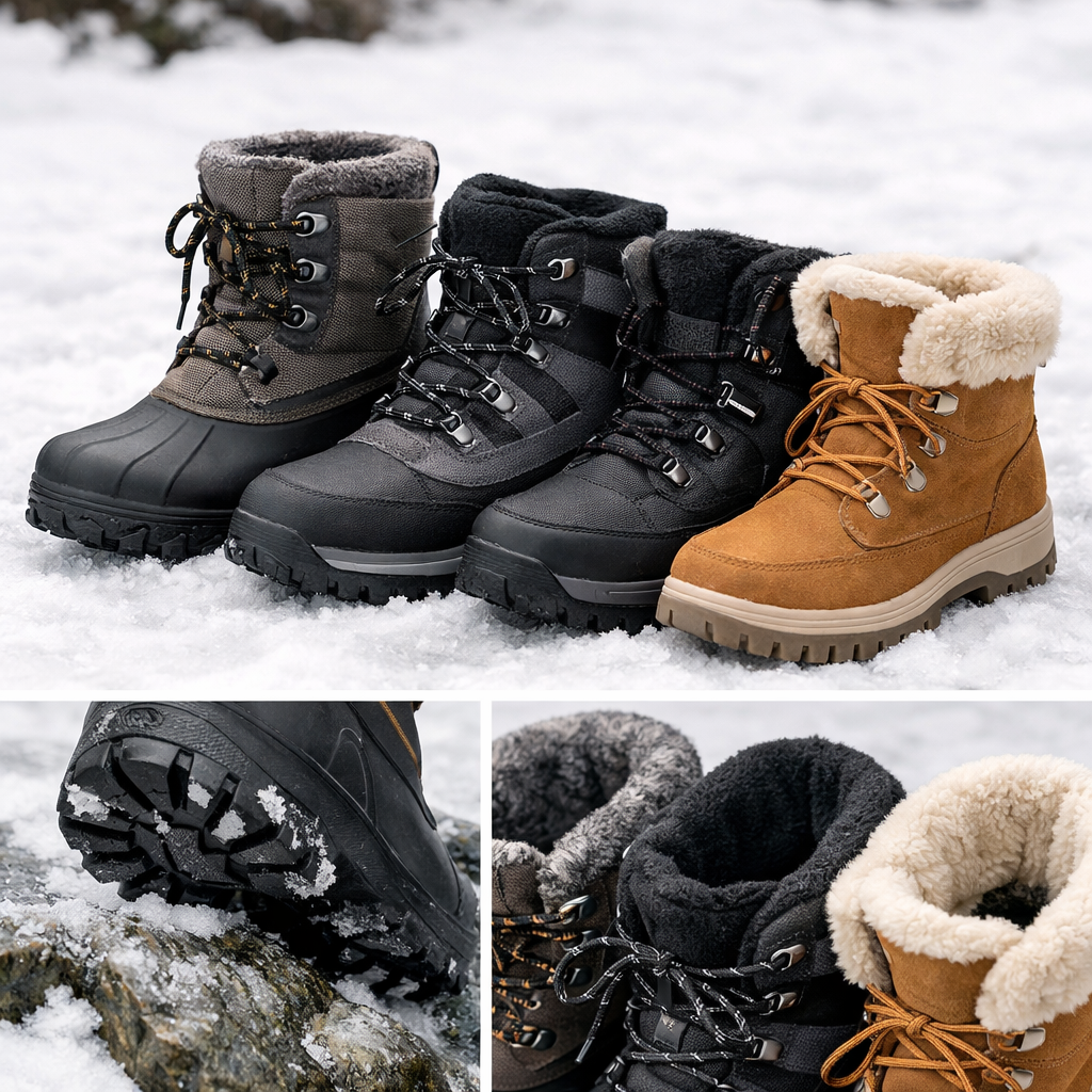
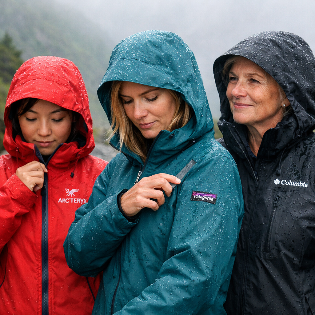
Trusted Outdoor Brands for Weatherproof Women’s Jackets, Editor-Tested Picks At Hiking Manual, “weatherproof” means a jacket blocks wind, sheds rain and snow, and keeps you comfortable across shifting conditions. “Waterproof” adds fully sealed seams and a tested membrane that prevents water ingress under pressure. For fall, prioritize rain and wind resistance with breathability. For winter, you need a sturdier shell that pairs cleanly over warm midlayers for snow, spindrift, and long, cold hours on trail. “Hydrostatic head (HH) is a lab test that measures water resistance in millimeters; for s...
read more